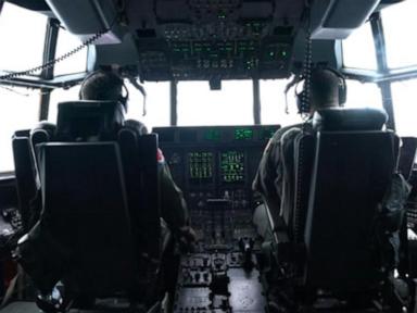
Accurate hurricane forecasting depends entirely on resolving data deficits in the marine boundary layer, where satellites fail to measure pressure drops and wind vector gradients directly. Surface-level satellite imagery captures cloud-top morphology, but it cannot pierce the inner core dynamics of a mature tropical cyclone. When National Oceanic and Atmospheric Administration (NOAA) WP-3D Orion turboprops and Gulfstream IV-SP jets intercept systems like Hurricane Isaias, they bypass the optical limitations of remote sensing to capture in-situ thermodynamic data. This operational workflow transforms abstract meteorological tracking into an empirical baseline for numerical weather prediction models.
The Three Pillars of Airborne Data Acquisition
Direct meteorological penetration relies on three distinct instrumental mechanisms deployed simultaneously within high-turbulence environments. Learn more on a similar topic: this related article.
First, dropwindsondes provide vertical profile measurements. Released from flight level down to the ocean surface, these cylindrical instruments deploy a parachute and stream real-time data on barometric pressure, temperature, relative humidity, and GPS-derived wind speed and direction. This vertical slice reveals the exact thermal stability and moisture distribution of the eyewall.
Second, airborne Doppler radar systems mounted on the aircraft scan the precipitation and wind fields surrounding the core. While ground-based radar loses fidelity far offshore, airborne tail radars paint a three-dimensional volumetric picture of precipitation echoes and wind velocity vectors. This pinpoints secondary eyewall replacement cycles and localized convection bursts before they register on land-based networks. Additional reporting by The Washington Post delves into related views on the subject.
Third, microwave radiometers and flight-level sensors record continuous static pressure and surface wind indices. By calculating the exact barometric gradient between the outer environment and the inner vortex, meteorologists compute minimum central pressure with a high degree of precision, bypassing the estimations inherent in Dvorak satellite intensity techniques.
The Cost Function of Forecast Error
Numerical weather prediction models—such as the Global Forecast System (GFS) and the Integrated Forecasting System (IFS)—operate on fluid dynamics equations that are notoriously sensitive to initial conditions. A minor error in assessing the initial vortex position or minimum central pressure compounds non-linearly over a 72-hour forecast window, leading to hundreds of miles of track divergence and catastrophic landfall timing errors.
[Initial Data Deficit] ➔ [Model Initialization Error] ➔ [Non-linear Propagation] ➔ [Landfall Track Divergence]
When hurricane hunter aircraft penetrate a system like Isaias, they directly mitigate this initial state error. By feeding real-time dropsonde profiles directly into the National Centers for Environmental Prediction, the models adjust their internal mass-wind balance fields. This data injection reduces track and intensity error margins by up to thirty percent during the critical 48 hours prior to coastal impact.
Operational Constraints and Structural Limitations
Despite the unmatched fidelity of airborne reconnaissance, the methodology faces rigid logistical constraints.
Flight hours are bound by structural fatigue limits and fuel capacity windows. A typical mission inside a major hurricane lasts between eight and ten hours, requiring constant aircraft rotation that strains fleet availability during hyper-active seasons. Furthermore, flying through the extreme updrafts and downdrafts of an intensifying eyewall exposes aircrews to severe mechanical turbulence, structural icing, and lightning strikes.
Remote sensing alternatives, including high-altitude uncrewed aerial systems and satellite scatterometry, attempt to bridge these coverage gaps. However, scatterometers struggle with signal attenuation in heavy rain bands, and uncrewed platforms face high attrition rates in severe convective environments. Consequently, crewed aircraft remain the gold standard for high-stakes inner-core data collection.
Strategic Integration into Numerical Models
To maximize the utility of these flights, data assimilation algorithms must process asynchronous observations without destabilizing the model's physical balance. Assimilating high-resolution wind and pressure coordinates requires advanced variational data assimilation techniques that weigh observational error against background model uncertainty.
As computational power scales, the future of hurricane analysis hinges on coupling high-frequency airborne reconnaissance directly with machine learning weather models. Feeding precise, real-time boundary layer data into neural network architectures accelerates forecast generation from hours to seconds. The operational imperative remains clear: closing the observational gap at the storm center is the single most effective intervention for reducing coastal vulnerability.