Twenty-one stone artefacts. Two drowned sites. One headline begging you to picture an Atlantis of ancient Aboriginal cities.
Hold your breath. The science matters. The hype is lazy.
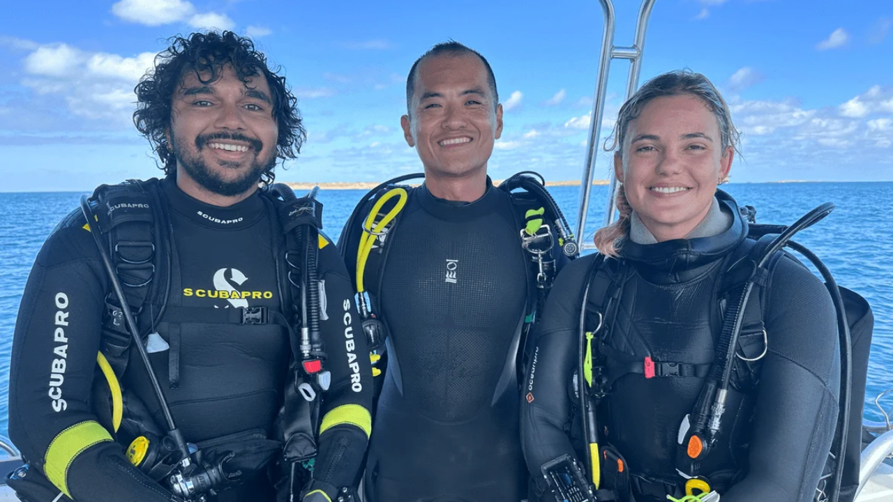
Recent coverage of the Quaternary Science Reviews study led by Professor Jonathan Benjamin alongside Murujuga Aboriginal Corporation rangers—including co-authors Malik Churnside and Richard Variakojis—takes real, hard-won underwater fieldwork off Murujuga in Western Australia's Dampier Archipelago and flattens it into a comfort-food story. You get the neat package: ancient people lived on dry land, the sea rose at least 9,000 years ago, and stone moved 23 kilometres.
That summary misses the real mechanics. Worse, it hands the wrong questions to anyone trying to understand coastal prehistory, marine heritage compliance, or what actually sits under the two million square kilometres of drowned Australian continental shelf.
What the Competitor Article Gets Wrong (And What It Glossed Over)
Standard coverage treats a 23-kilometre stone movement as proof of grand long-distance trade routes or sweeping migrations across a vanished world. Look closer at the numbers and geology.
Twenty-three kilometres is roughly 14 miles. In an arid-to-semi-arid coastal plain like the Pilbara—even when sea levels sat lower and opened up territory—23 kilometres is a solid day's walk, not a transcontinental expedition. And the sample size is small. At the submerged spring site in Flying Foam Passage, divers hauled up 158 encrusted rocks across eight dives; after acid soaking to strip marine growth, only nine proved to be artefacts. Across the two sites, the recovered lithic assemblage totals roughly 21 pieces—cores, flakes, and retouched pieces—with around 44% at the spring linked via X-ray fluorescence to volcaniclastic sedimentary rock outcropping near Rosemary Island.
That is a real signal. It is not a blockbuster movie.
Three lazy assumptions keep showing up in mainstream reporting on this work:
- Confusing inundation age with artefact age. A site drowned at least 9,000 years ago gives you a minimum age for submersion—the lid on the jar, not the date stamped on what went inside. Stone tools can sit on a land surface for millennia before the ocean swallows them.
- Assuming "moved 23 km" equals "trade." A person walking with a favoured core or tool from Rosemary Island toward a reliable freshwater spring produces the exact same geochemical signature as an exchange network between two groups. The study itself notes that individual mobility and inter-group exchange cannot be separated from these finds alone.
- Treating shallow finds as the main event. Everything documented so far sits within roughly 10 to 15 metres of water—well inside the 30-metre contour—while the full drowned coastal plain stretches out toward roughly 130 metres depth.
Stop Asking "How Old Are They?" Ask What Survived the Surf
People love asking for a single neat date: How old are these underwater tools?
Wrong question. In lithic archaeology and marine geoarchaeology, taphonomy—the study of decay, burial, displacement, and preservation after an object is discarded—is the gatekeeper of truth. A stone flake doesn't rot like bone, wood, or shell. That sounds great until you realize waves, tidal currents, storm surge, and anchoring can roll, chip, abrade, or scatter stone across a seabed.
In passages like Flying Foam Passage, divers work narrow windows during neap tides when currents slacken, judging shape and fracture angles through marine growth. Think about how hard that is. A flake is a piece of stone struck from a parent rock—a core—using controlled force to create a sharp edge or blank. Retouch is secondary flaking along an edge to resharpen or reshape a tool. Under a crust of calcified algae, barnacles, and sediment, a genuine struck flake with a bulb of percussion can look identical to a wave-battered cobble.
A stone artefact sitting on a drowned river terrace or beside a submerged freshwater spring isn't a time capsule frozen in amber. It is a survivor of post-glacial marine transgression that had to beat wave energy, sediment scour, and modern human eyes just to be counted.
I have watched major infrastructure and marine survey budgets get blown chasing flashy targets in the wrong zones because teams treated seabed mapping like a treasure hunt instead of a geomorphic filtering problem. If you don't map relict river channels, palaeovalleys, springs, and sheltered basins first, you end up diving blind over barren rock or sand sheets where everything either washed away or got buried under metres of mobile sediment.
That is why the contrast between the two Murujuga sites is actually the smartest part of the paper:
- The submerged spring site functioned as a focal point—a place with fresh water where people arrived with varied stone, including material from ~23 km away near Rosemary Island.
- Maitland River Hummock sat beside an ancient river channel and leaned heavily on local stone—a quarrying and expedient-working spot rather than a long-haul import hub.
That contrast—distant selection at a water source versus local rock at a rocky rise overlooking a palaeo-channel—tells you how task-specific behaviour worked across a changing landscape. It also matches what Murujuga rangers and Ngarda-Ngarli Traditional Owners have been saying for years: Country doesn't stop at the tide line, and oral history and scientific diving reinforce each other rather than competing.
"People Also Ask" — Dismantled
Did Aboriginal Australians build underwater settlements that sank?
No—and framing it that way distorts both the archaeology and the history. These sites are open-air lithic scatters and landscape features (a drowned spring depression and a rocky hummock by a former river channel), not sunken stone cities. Across Australia, post-glacial sea-level rise flooded more than two million square kilometres of continental shelf, reshaping coastlines and forcing adaptations over thousands of years. Calling every submerged artefact site a "lost city" is clickbait that cheapens real hunter-gatherer and coastal land-use science.
How can researchers tell a 9,000-year-old stone tool from a regular rock underwater?
By looking for diagnostic human fracture mechanics—striking platforms, bulbs of percussion, dorsal flake scars, and systematic retouch—backed by geochemical sourcing such as X-ray fluorescence to match raw stone to geological outcrops. Even then, it is slow, gritty work. Divers bring up candidate rocks, clean off marine growth, and separate real artefacts from natural breaks.
Why does moving stone 23 km matter if people walked that far all the time?
Because provenance pins down direction, choice, and connectivity on a map that is now mostly ocean. Knowing that stone from near Rosemary Island turned up at a spring roughly 23 km away—while nearby island/knoll assemblages leaned local—shows differential raw-material provisioning across the landscape before rising seas turned hills into islands and valleys into channels.
Thought Experiment: What Happens When We Scale Offshore Surveys?
Imagine a scenario where funding doubles next year for deep-shelf surveys out to 100 metres depth across the Pilbara. Better boats, side-scan sonar, sub-bottom profilers, and faster image-recognition tools all go to work.
You would almost certainly find older drowned landforms and more stone artefacts—because older shorelines sit deeper on the shelf. Yet you would also hit a brutal statistical wall: the deeper and older you go, the fewer intact surface scatters survive unburied or un-reworked, and the harder it becomes to prove direct human agency over a single isolated flake without strong geological context. More sonar pings won't automatically give you precision dating on bare stone.
Where My Contrarian Take Can Backfire
Being blunt about small sample sizes and hype has a real downside if you take it too far.
Downplay a 21-piece underwater lithic find because "it's only 21 stones," and you risk underestimating the sheer technical hurdle of finding anything intact on a high-energy, encrusted seabed. In marine archaeology, proof-of-concept sites matter enormously. They prove stone survives underwater in those specific settings, refine survey protocols for scientific divers and Indigenous rangers, and give regulators real baseline data before dredging, shipping lanes, or offshore energy projects disturb the seafloor.
Heavy hitters in submerged palaeo-landscape research—including Geoff Bailey, Sean Ulm, Jo McDonald, and Jonathan Benjamin—have spent years building this field from scratch because for decades conventional wisdom assumed the sea destroyed almost all traces of ancient coastal life. Skepticism shouldn't turn into dismissal.
Actionable Moves for Anyone Actually Working This Space
If you are a researcher, heritage planner, or serious reader trying to get real value out of submerged archaeology rather than recycling press releases:
- Map geomorphology before dropping divers. Target drowned river channels, spring depressions, and sheltered basins where sediment traps or topography protect deposits—not random patches of bare seafloor.
- Treat inundation dates as ceilings, never dates of manufacture. Always ask what happened before flooding versus during and after marine transgression.
- Pair lithic analysis with local Indigenous knowledge from day one. Co-designing surveys with Murujuga rangers and Traditional Owners isn't PR box-ticking; it shapes where you look and how landscape stories are interpreted.
- Demand raw-material sourcing on every transport claim. Never accept "moved X kilometres" unless the geological outcrop match and sample context are clear.
Stop worshipping the headline number and start reading the seabed like a detective.