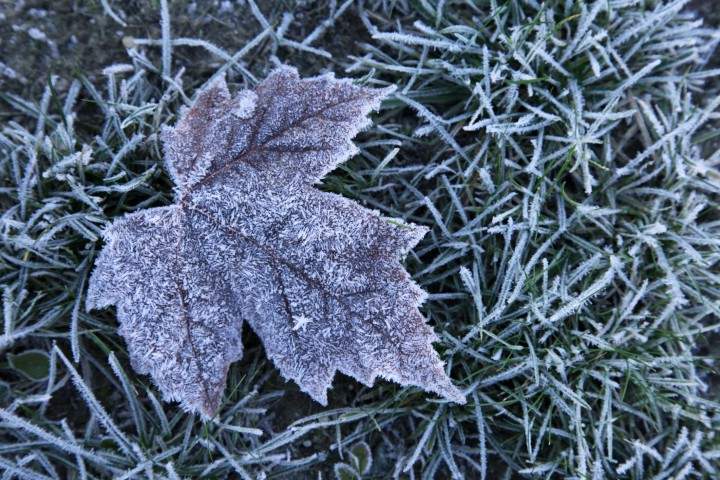
Standard frost advisories issued for Toronto treat a city of distinct microclimates as a single thermostat, overlooking the thermodynamics that actually freeze plant tissue. A "yellow" frost advisory from Environment Canada signals moderate, short-term risk when overnight temperatures approach or dip slightly below zero, typically during transitional autumn nights. Yet a regional low of 2 C or 3 C at an airport weather station does not guarantee uniform frost across the Greater Toronto Area. Surface radiative cooling, lake modification, urban heat retention, and topographic air drainage routinely push exposed pockets several degrees colder than reported shelter air temperatures.
To turn a routine weather alert into an operational decision, analysts and property managers need a structured blueprint: Read more on a related topic: this related article.
- Deconstruct the baseline advisory logic and identify where standard reporting stops short of ground-level risk.
- Separate the physical drivers of frost formation from secondary microclimate amplifiers across Toronto.
- Evaluate plant and asset exposure through a clear risk-and-cost framework rather than generic "cover your plants" advice.
- Execute a timed, step-by-step response sequence with explicit operational limits.
Deconstructing Standard Frost Coverage
Routine weather summaries on overnight frost advisories follow a predictable four-part skeleton: announce the yellow advisory status, state the expected low temperature window, note a geographic split between areas near Lake Ontario and areas farther inland or north of Highway 401, and advise residents to cover sensitive plants. That structure informs readers that cold air is arriving, yet it leaves major causal gaps.
The first blind spot is the difference between shelter air temperature and surface or foliage temperature. Standard meteorological observations measure air temperature inside a ventilated screen roughly 1.5 to 2 meters above ground. Under clear skies and light winds at night, surfaces lose heat via outgoing longwave radiation faster than the surrounding air can replenish it. Leaves, mulch, and low-lying turf can drop below 0 C while the official forecast calls for a low of 2 C or 3 C. Additional journalism by Reuters delves into related perspectives on the subject.
The second blind spot is the wind-cloud-moisture interaction. A frost advisory does not automatically produce visible white hoarfrost on every surface. Frost requires surface temperatures at or below freezing alongside sufficient ambient moisture reaching saturation (dew point or frost point). Moderate wind mixes warmer air downward and can prevent extreme surface cooling, whereas calm, clear nights maximize radiative heat loss while still allowing localized cold pockets to form.
The third blind spot is treating "areas north of Highway 401" and "areas near Lake Ontario" as static labels rather than dynamic gradients. Proximity to a large body of water moderates temperature swings because water has a high heat capacity and mixes vertically, but wind direction determines how far inland that thermal buffer reaches. When winds blow off the lake, shoreline neighborhoods stay milder; when winds shift offshore or calm down under high pressure, inland cooling spreads further south.
The Physics and Microclimate Architecture of Frost
Understanding why frost hits one yard in Toronto and spares another requires mapping cause and effect across three layers: radiative heat balance, urban-lake thermal gradients, and local terrain.
Radiative Heat Loss and Boundary Layer Dynamics
At night, surfaces emit infrared (longwave) radiation upward. Without a cloud deck to absorb and re-emit part of that energy back downward, net radiation at the ground is strongly negative. Air right above the surface cools by conduction, creating a stable temperature inversion where cold, dense air sits near the ground beneath warmer air above.
- Cloud cover: Acts as a partial thermal blanket; overcast skies reduce net radiative cooling compared with clear skies.
- Wind speed: Strong gusts stir the lowest tens of meters of the atmosphere, importing warmer air from aloft; calm or very light wind allows steep surface cooling.
- Surface moisture and emissivity: Damp soil or wet foliage behaves differently from dry mulch or bare rock because water changes thermal conductivity and latent heat exchanges.
- Elevation above ground: Low-growing perennials, groundcovers, and unheated containers sit deeper inside the cooled boundary layer than upper tree canopies.
The Lake Ontario Buffer vs. Urban Heat Island
Toronto sits at the intersection of two competing thermal influences: Lake Ontario's moderating mass and the city's built environment. During autumn, Lake Ontario retains heat accumulated over the summer months longer than land surfaces do. Near the shoreline, that stored heat helps keep overnight minimums higher than in inland suburbs.
At the same time, dense urban neighborhoods—asphalt roads, concrete walls, brick buildings, and compact street canyons—absorb solar radiation during the day and release sensible heat slowly after sunset. That urban heat island effect often keeps downtown core readings warmer than rural or semi-rural fringes. However, the lake effect and urban heat effect do not cancel out uniformly across the metro area. A sheltered park hollow or valley edge can cool sharply even inside city limits, while an open lot exposed to a brisk breeze may stay warmer than a stagnant hollow.
Cold-Air Drainage and Micro-Topography
Cold air is denser than warm air. On sloped terrain—such as ravine edges, river valleys, or graded yards—cooled surface air flows downhill under gravity and pools in low spots or basins. A depression just one or two meters lower than surrounding ground can trap cold air for hours.
A practical example illustrates this mechanism. Consider two ornamental beds separated by thirty meters on a sloped property north of the core: one sits on a slight rise near a south-facing masonry wall, and the other sits in a low, unshaded hollow bordered by dense shrubs that block airflow. On a calm, clear night with an official forecast low of 2 C, the masonry wall radiates stored heat and limits sky view, while the hollow traps sinking cold air and loses heat unimpeded to a clear sky. Frost damage is far more likely in the hollow even though both beds sit under the exact same advisory.
Exposure, Damage Mechanisms, and Cost Trade-Offs
Frost damage in plants is not a single binary event; it depends on tissue water content, solute concentration, cooling rate, and species tolerance. When ice crystals form inside plant cells (intracellular freezing), expanding ice ruptures cell membranes and kills tissue directly. Even when ice forms first in spaces between cells (extracellular freezing), ice draws liquid water out of cells due to vapor pressure differences, causing cellular dehydration and structural stress.
Evaluating frost risk as a cost-and-exposure trade-off clarifies where effort pays off and where it does not:
- High-value, low-volume assets: Tender annuals, newly planted ornamentals, culinary herbs, and potted plants have shallow root zones and high exposure because container soil cools from the sides as well as the top. Targeted protection here offers high return for modest labor.
- Established hardy perennials and woody trees: Many native and mature autumn-adapted plants harden off as day length shortens and cool nights arrive, tolerating light frosts that scorch tender summer foliage. Blanket-covering large mature trees is rarely practical or necessary for a mild advisory.
- Cover material mechanics: Fabric frost cloths, bedsheets, or burlap trap upward heat radiation while allowing some air exchange. Plastic sheeting can also trap heat, yet if plastic touches leaves directly, it conducts cold to the foliage and can worsen damage if daytime sun heats trapped air rapidly.
- Labor and time cost: Covering dozens of plants late at night costs time and increases error rates; prioritizing by replacement cost, aesthetic value, and microclimate exposure prevents wasted effort.
In meteorology and horticulture, known facts include the physics of radiative cooling, the general moderating role of Lake Ontario on nearby temperatures, and the advisory definition of moderate, short-term impact. By contrast, exact frost occurrence on any specific block on a given night—and the exact degree of cellular injury on an unexamined plant variety—remains an educated forecast and risk estimate until ground sensors or morning inspection confirm actual surface conditions.
Tactical Execution Protocol for Frost Nights
When an overnight frost advisory is issued for Toronto, execution works best as a disciplined sequence timed to sunset and sunrise rather than a last-minute scramble.
- Audit microclimates before dusk: Walk the property in late afternoon to flag low pockets, wind-sheltered hollows, and exposed containers. Separate tender plants and pots from hardy established beds.
- Manage soil moisture earlier in the day: Moist soil conducts and stores heat better than dry, loose soil, helping buffer surface temperatures at night—provided drainage is adequate and roots are not waterlogged. Avoid late-evening overhead watering that leaves standing water on cold foliage right before sub-freezing temperatures hit.
- Deploy covers before peak cooling sets in: Drape breathable covers (such as frost fabric or old sheets) before evening temperatures fall sharply so you trap daytime residual heat rather than sealing in already-chilled air. Anchor edges with stones, soil, or stakes so wind does not strip covers off.
- Keep covers off tender foliage where possible: Use hoops, stakes, or plant cages to keep covers from pressing directly against leaves, reducing contact conduction and mechanical bruising.
- Unveil and inspect after morning warming: Remove covers once morning temperatures rise above freezing and sun does not overheat enclosed air. Inspect stems and leaves for water-soaked dark patches or limpness, and prune dead tissue only after new growth or clear boundaries confirm what survived rather than cutting live wood prematurely.
Operational Limits and Boundary Conditions
No frost-protection routine eliminates risk under every weather regime. Covers and passive thermal retention work best during radiation frosts—calm or light-wind nights with clear skies where temperatures dip only a few degrees near or just below zero. They lose effectiveness during advection freezes, when a strong cold air mass pushes across the region with persistent winds and deep sub-zero temperatures that overwhelm trapped ground heat.
Containerized plants face an additional boundary condition: above-ground pots lack earth insulation around their root ball, so a prolonged cold snap can freeze roots even when top growth is covered. Likewise, weather forecasts carry inherent spatial and temporal uncertainty; localized cloud bands, shifts in wind speed, or sudden lake-breeze changes can alter overnight minimums by a couple of degrees from station readings.
Strategic Recommendation for Late-Autumn Operations
Treat every autumn frost advisory in Toronto as a microclimate triage trigger, not a blanket emergency across the entire property. Concentrate protective labor and materials on high-value, cold-sensitive, and container-grown plants situated in low-lying or open-sky microclimates during calm, clear nights, while letting hardy, established landscape stock rely on seasonal acclimatization unless forecasts shift toward sustained, deep sub-freezing advection.


