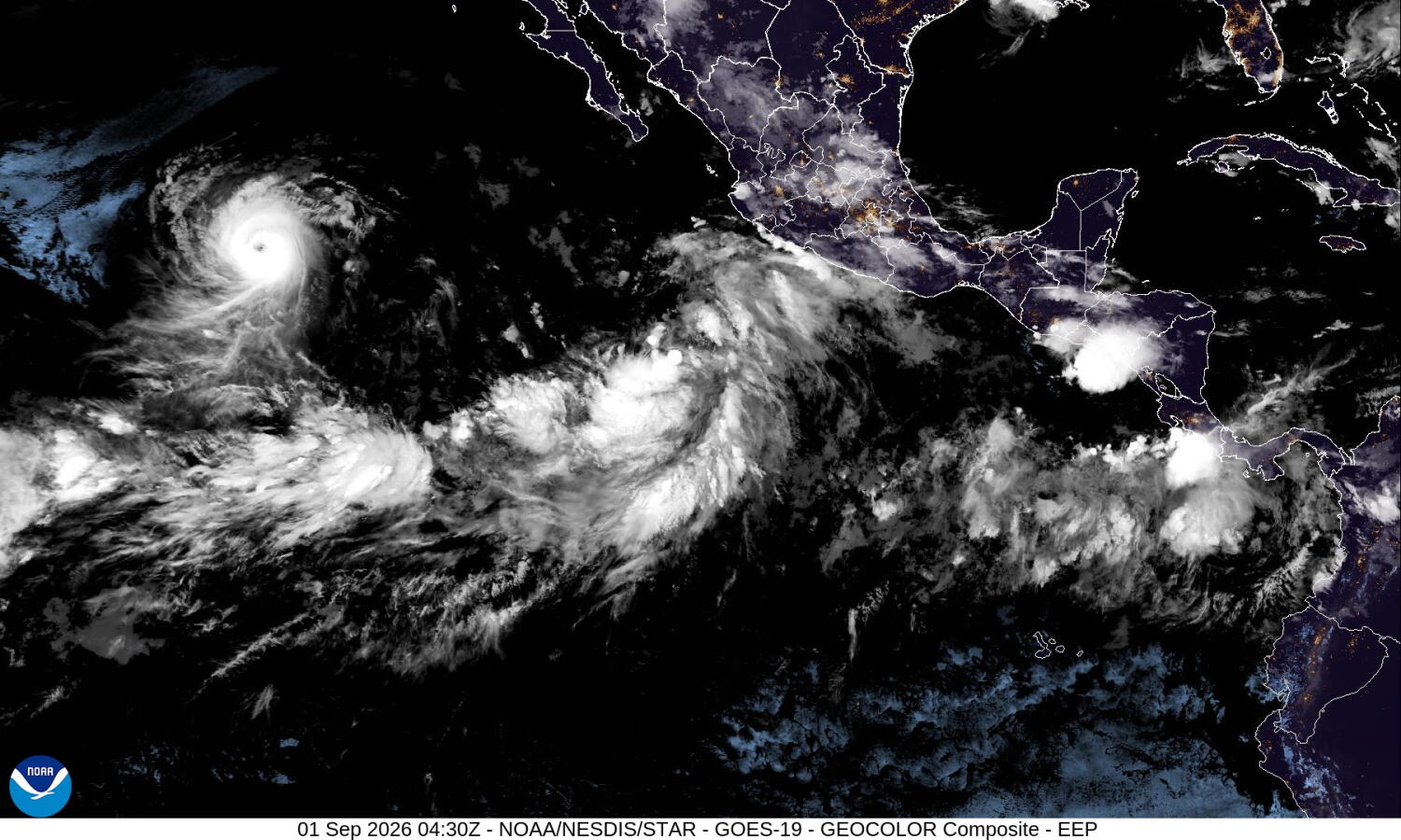
Southern California will not face a direct hurricane landfall over Labor Day weekend, but active tropical moisture in the eastern Pacific is already weaponizing coastal waters with heavy surf, dangerous rip currents, and high humidity while forcing meteorologists to closely track an erratic developing disturbance.
The public obsession with whether a category-strength storm will smash directly into Los Angeles or San Diego misses the fundamental mechanics of how tropical systems actually impact the region. History and atmospheric physics demonstrate that a system does not need to retain its tropical card-carrying status to paralyze local infrastructure. When Hurricane Hilary transitioned into a post-tropical remnant before dumping months of rain in a single afternoon back in August 2023, it proved that the name on the National Hurricane Center advisory matters far less than the sheer volume of atmospheric moisture being hauled north by steering currents.
Right now, weather prediction models are monitoring a fresh eastern Pacific disturbance with high odds of tropical genesis. Sensationalized headlines love to throw around words like hurricane and landfall when discussing these anomalies, capitalizing on collective anxiety after recent extreme weather events. Yet seasoned forecasters at the National Weather Service operate with a much higher threshold of skepticism. They know that as tropical systems track north toward the colder ocean waters off the Baja California peninsula, they typically encounter a hostile environment characterized by dropping sea surface temperatures and high vertical wind shear. These elements act as an atmospheric brake, stripping the system of its warm core and turning it into an elongated moisture plume long before it crosses the international border.
This dynamic creates a profound communication gap between meteorologists and the public. When an early computer model run shows a hypothetical closed low-pressure center spinning off the coast of Mexico, it sparks immediate online panic. Social media algorithms amplify the most extreme trajectories. The reality on the ground is far more nuanced. Even if a system fails to organize into a classic tropical storm or hurricane, the surrounding plume of tropical moisture can interact with local topography, wringing out torrential rains over mountain passes and desert flash-flood zones while leaving coastal basins relatively untouched.
Consider the geography of the region. Southern California is a landscape defined by sharp topographical contrasts. Transverse and Peninsular mountain ranges act as massive physical walls standing directly between incoming maritime moisture and inland valleys. When easterly or southeasterly mid-level winds push a decaying tropical plume against these mountain barriers, orographic lift forces the saturated air rapidly upward. This process cools the air adiabatically, condensing water vapor at an accelerated rate and producing localized rainfall totals that can dwarf anything seen in flat coastal cities.
During the historic 1939 tropical storm that made landfall near Long Beach, communities in the foothills and mountains absorbed catastrophic water volumes while beachgoers experienced entirely different manifestations of the storm. The same mechanics apply today. A holiday weekend traveler heading to the desert or the mountains faces completely different hazards than someone lounging on a Santa Monica beach.
Ocean conditions present the most immediate and tangible hazard during these atmospheric setups. Long-period swells generated by distant systems like Hurricane Karina are already propagating northward, creating treacherous surf conditions along southern-facing beaches. Lifeguards across Los Angeles and Orange Counties routinely field spikes in water rescues during these events because tourists underestimate the power of secondary swells. Water temperatures hovering in the mid-seventies provide a deceptive sense of security, masking the underlying threat of powerful rip currents capable of pulling experienced swimmers into deep water.
Infrastructure vulnerability remains the ultimate wildcard in this ongoing seasonal drama. Southern California is engineered to handle Mediterranean climate norms—dry summers punctuated by moderate winter storms. Urban drainage systems are built to channel rapid, high-volume runoff from sudden downpours into concrete flood control channels and out to the Pacific. However, when a tropical remnant drops a month's worth of rain in a few hours, debris basins quickly clog with sediment, brush, and urban litter.
Burn scars from recent wildfire seasons compound this danger exponentially. Stripped of vegetation and root structures, steep hillsides in the San Gabriel and Santa Ana mountains cannot hold water. A moderate pulse of tropical rain over a recent burn scar triggers immediate mud and debris flows that can block major commuter arteries and isolate mountain communities within minutes. City planners and emergency management agencies understand this vulnerability intimately, which is why flash flood watches are issued long before a drop of rain actually falls on downtown asphalt.
Climate patterns are also shifting the baseline expectations for the eastern Pacific basin. Unusually warm marine temperatures act as an expanded fuel tank for tropical cyclogenesis further north and later into the calendar year. When ocean heat content remains elevated well into the autumn months, storms that would historically fizzle out over cold water can maintain their structure much further up the coast. This does not mean Southern California is suddenly becoming a tropical outpost, but it does mean the statistical probability of experiencing moisture-laden tropical remnants is creeping upward.
Emergency preparedness in this environment requires moving past the binary question of whether a hurricane will hit. Residents and visitors need to evaluate specific microclimate risks. If you are camping in an arroyo or driving through desert mountain passes over a holiday weekend when tropical moisture is surging overhead, the threat of sudden flash flooding is immediate and life-threatening, regardless of what the storm is officially named.
Forecasting models will continue to wobble over the coming days, shifting tracks hundreds of miles east and west with every new computer run. That uncertainty is an inherent feature of chaotic atmospheric systems, not a failure of meteorological science.
Keep an eye on official updates from the National Weather Service rather than viral weather graphics. Respect the ocean when marine advisories warn of dangerous surf. Clear out domestic rain gutters before heading out of town.
The next atmospheric anomaly is already spinning over the warm waters to the south, and the outcome will be written on the radar screen, not in the panic of social media feeds.