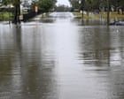
When emergency crews pull a body from Queensland flood waters after days of relentless storms and a multi-day deluge, the headlines treat it like a freak tragedy. It is not. Another fatal drowning in a submerged vehicle or a swollen creek is the predictable outcome of an infrastructure bottleneck, outdated urban drainage, and a fatal misunderstanding of how modern convective rain bombs actually behave on the ground.
The immediate story is always the same. A low-pressure trough stalls over the Queensland coast, dumping hundreds of millimeters of rain onto already saturated catchments, turning suburban streets and rural highways into lethal rapids. Yet the deeper, uncomfortable reality is that Queensland’s rapid population growth has outpaced its hydrological engineering, leaving residents trapped between billion-dollar forecasting technology and 1970s-era road crossings.
The Anatomy of a Stalled Deluge
Most people think of a major storm as a passing event. It blows in, dumps rain, and moves offshore.
What makes Queensland’s multi-day deluges uniquely lethal is atmospheric blocking. When a high-pressure system sits stubbornly over the Tasman Sea, it acts like a brick wall, preventing coastal troughs from moving east. Moisture-laden air from the Coral Sea is continuously funneled into the same narrow corridor of coastline or hinterland for 72 to 96 hours straight.
In meteorology, this is known as training thunderstorms. Imagine a freight train where every single railcar passes over the exact same stretch of track. Instead of a storm cell moving across a region and spreading the rainfall over a wide area, new cells repeatedly form upstream and track over the exact same river basin.
Saturation and the Runoff Cliff
During the first 24 hours of a deluge, the soil acts like a sponge. Dry earth absorbs a massive percentage of the initial rainfall, which often lulls drivers and homeowners into a false sense of security. The creeks rise, certainly, but they stay mostly within their banks.
Then the catchment hits its saturation threshold. Once the soil profile is completely full, the ground effectively turns into concrete. Every subsequent millimeter of rain becomes 100 percent surface runoff. A creek that took two days to rise two meters can suddenly jump another four meters in forty minutes. This nonlinear spike is where the fatalities happen. People drive out on roads that were completely passable an hour earlier, only to encounter a wall of fast-moving water at the next dip.
The Physics of a Submerged Vehicle
If you ask swift-water rescue technicians what kills the majority of people during Queensland storms, they will point to a single piece of machinery. The modern family car.
There is a dangerous myth among drivers that a heavy four-wheel drive with a snorkel and raised suspension can safely ford a flooded causeway. That belief is mathematically wrong. Water weighs roughly one metric ton per cubic meter. When water is moving, it exerts dynamic lateral pressure that scales exponentially with its velocity.
- Just 15 centimeters (six inches) of water is enough to reach the bottom of most passenger cars, causing loss of control and potential stalling as water enters the exhaust or air intake.
- 30 centimeters (one foot) of moving water will float almost any standard sedan, stripping the tires of friction against the asphalt.
- 60 centimeters (two feet) of rushing water will sweep away nearly every vehicle on the road, including heavy dual-cab utes and large SUVs.
Consider a hypothetical scenario on a typical rural Queensland causeway. A driver approaches a 30-meter stretch of submerged tarmac where the water looks calm and barely reaches the hubcaps. Halfway across, the roadbed beneath the water has been scoured away by the current, dropping the vehicle into a hidden washout. Simultaneously, the buoyancy of the air trapped inside the cabin lifts the tires off the road. Without tire traction, the vehicle turns sideways, presenting its broadside to the current. Within seconds, tons of lateral water pressure roll the vehicle into the deeper drainage channel alongside the road.
Where Forecasting Meets the Last-Mile Failure
Australia possesses some of the finest meteorological talent and Doppler radar networks in the southern hemisphere. The Bureau of Meteorology can track a severe storm cell down to the kilometer and issue flash flood warnings with remarkable accuracy.
So why do people still end up dead in the water? Because there is a massive structural gap between a regional weather warning and street-level reality.
When an emergency alert flashes on a smartphone screen warning of "life-threatening flash flooding" across a 500-square-kilometer local government area, it suffers from alert fatigue. Residents who have received four similar text messages over the past three days—and looked out their window to see only light drizzle—begin to tune them out. The warning system tells you what is falling from the sky, not which specific bridge three kilometers down the road just collapsed.
The Infrastructure Deficit
Queensland has thousands of low-level floodways and unmonitored creek crossings. Installing automated depth gauges, boom gates, and telemetry sensors at every rural crossing costs millions of dollars that local councils simply do not have.
Even in major urban centers like Brisbane, the Gold Coast, and Townsville, stormwater infrastructure is frequently overwhelmed by short-duration, high-intensity rainfall. Municipal drainage pipes are typically engineered to handle a one-in-ten or one-in-twenty-year storm event. When a stalled storm system dumps 150 millimeters of rain in two hours, those pipes surcharge. Water backs up through the grates, turning suburban intersections into retention basins.
The Hidden Dangers After the Rain Stops
The media cameras usually pack up the moment the sun breaks through the clouds. For emergency services, however, the receding phase of a multi-day deluge carries its own lethal hazards.
Floodwater is never just rainwater. As rivers overtop their banks, they inundate agricultural land, industrial estates, septic systems, and sewage treatment plants. The resulting brown torrent is a toxic slurry of raw sewage, agricultural pesticides, heavy metals, and hydrocarbons. Entering this water—whether to rescue livestock, retrieve property, or simply wade back to a flooded home—exposes people to severe bacterial infections like melioidosis and leptospirosis.
Submerged Traps and Structural Collapse
Even more immediate is the physical trauma hidden beneath the opaque surface. Floodwaters strip away manhole covers, uproot trees, and tangle barbed-wire fencing across submerged paddocks and parklands. Someone walking through waist-deep water can easily step into an open storm drain and be sucked underground by the hydraulic pressure of the drainage network.
Downed powerlines present another silent killer. While automated grid switches usually cut power when a line hits the ground, older infrastructure or back-feeding from improperly installed residential generators can energize standing water over a wide radius.
The Economics of Building in the Floodplain
To understand why Queensland remains perpetually vulnerable to these multi-day storms, you have to follow the property development maps. For decades, relentless interstate migration has driven aggressive residential expansion across Southeast Queensland and the coastal strips.
Land that was historically avoided because it sat on natural alluvial floodplains was rezoned, raised with landfill, and covered in asphalt and concrete roofs. Every new housing estate replaces permeable grassland with impervious surfaces. Instead of soaking into the earth, rainwater now shoots off roofs, down driveways, and directly into concrete gutters at high speed.
The Displacement Effect
When developers elevate a new housing tract above the one-in-one-hundred-year flood line using dirt fill, the water does not disappear. It is displaced. That displaced volume has to go somewhere, which often means pushing flood levels higher in older, neighboring suburbs that previously stayed dry.
Insurance companies have already done the math on this. Across large swathes of northern and southeastern Queensland, flood insurance premiums have skyrocketed to the point of being completely unaffordable, leaving thousands of homeowners functionally uninsured. The market is pricing in the reality that local zoning laws spent thirty years ignoring.
Surviving a Multi-Day Storm Event
Government inquiries, royal commissions, and infrastructure reviews will continue to debate dam release protocols and catchment management for years. None of those policy papers will help a driver staring at a flooded road at 2:00 AM during a blackout.
Survival during a major Queensland deluge comes down to rigid, non-negotiable personal protocols before the catchment hits its saturation point.
- Treat every flooded road as a washed-out road. You cannot see the asphalt beneath muddy water. Even if a local driver knows the road intimately, a few hours of intense flow can gouge a two-meter crater right where the tarmac used to be. Turn around and find higher ground, regardless of the detour time.
- Abandon stalled vehicles immediately. If your car stalls in rising water, do not waste precious seconds trying to restart the engine or gather bags from the back seat. Unbuckle your seatbelt, wind down the windows immediately before the electrical system shorts out, and exit toward the upstream side or higher ground. If the doors will not open due to external water pressure, break a side window using a dedicated spring-loaded escape tool—not the windshield, which is laminated to resist shattering.
- Never enter stormwater drains or flooded creeks on foot. Recreational swimming or bodyboarding in flooded drains during storm events remains a persistent cause of preventable deaths among teenagers and young adults. The hydraulic force at culvert intakes creates a vacuum effect that pins a human body against debris grates with hundreds of kilograms of force.
- Monitor river gauges, not just weather radar. Radar shows where it is raining right now; river height telemetry shows what is coming down the valley from the mountains. Check the Bureau of Meteorology’s specific river height bulletins for your local catchment to see if upstream gauges are still rising.
Until urban planning stops fighting basic hydrology and drivers stop gambling their lives against the weight of moving water, every major coastal trough will continue to write the exact same obituary.


