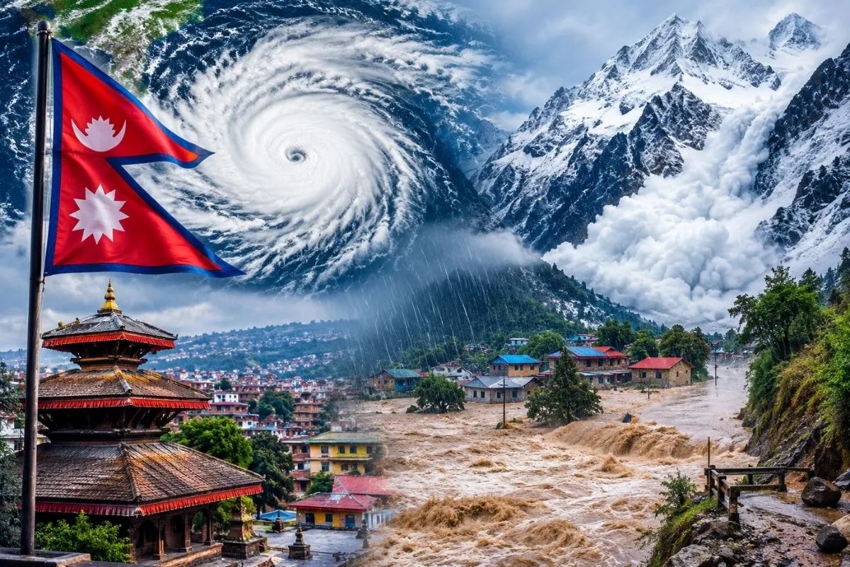
A 72-hour weather alert in Nepal is not a shield. It is a headline.
Competitor coverage loves the neat, terrifying bundle: three days of high alert, a cyclone or weather system spinning up, and a neat shopping list of threats stretching from valley floods to high-altitude avalanches and heavy snowfall. It sounds dramatic. It gets clicks. It also gets the physics and the institutional mechanics wrong in ways that quietly cost lives and millions in misdirected effort.
When authorities issue a three-day high alert—like the late-October 2026 warning tied to Cyclone Arnab that froze trekking permits in restricted zones and warned people away from riverbanks—the standard media script treats the calendar window as the whole story. Seventy-two hours starts. Seventy-two hours ends. Everyone exhales on day four.
That is lazy consensus. Mountains do not run on three-day news cycles.
The Lazy Consensus Behind "Three Days of Danger"
Standard coverage makes three big assumptions that fall apart on steep Himalayan terrain.
First, it treats floods, avalanches, and snowfall as three items on a menu rather than a chain reaction where one failure feeds the next. Snow loads a slope. Rain saturates unstable rock and moraine. A slide blocks a narrow gorge, builds a temporary dam, and blows out—sending a wall of water, ice, boulders, and timber roaring down a river valley. Calling that "flood risk" or "snowfall risk" in isolation misses how a single slope failure or dam breach turns a weather event into a high-speed debris flow.
Second, it assumes that a government alert equals readiness on the ground. A bulletin can tell tourists not to hike and tell residents to stay clear of riverbanks. It cannot magically create clear evacuation routes, pre-assigned local duties, or working river gauges when the surge hits.
Third, it treats the end of a three-day alert as safety. A saturated slope or a destabilized glacial-rock face does not clock out at midnight on day three. Lagged collapses, debris flows, and sudden river surges can unfold after the headline storm passes—or arrive with almost no lead time at all.
You Are Asking the Wrong Question
Most readers look at a three-day alert and ask: "Which specific hazard is going to hit hardest over these three days, and when is it over?"
Wrong question.
The right question is: Where can water, ice, and loose rock accumulate out of sight, and what happens when that storage fails all at once?
In steep mountain basins, water and debris do not just fall from the sky and vanish into a gauge. They pile up behind rockfalls, landslide dams, snowpacks, and glacial ice. A river gauge can look calm right up until it gets wiped out. During the August 26, 2026 disaster along the Bhote Koshi and Trishuli corridor, automatic gauges recorded low, falling water levels shortly before the surge destroyed stations downstream—and even far lower down on the Narayani at Devghat, the real story was how fast the river jumped, not just how high a static threshold read.
Think about what happens when a system measures water height at a few fixed points while ignoring rate of rise, upstream damming, and cross-border lag. You get false calm on a screen minutes before a wall of debris hits a settlement or highway.
What "People Also Ask" Gets Backward
"Why do officials ban trekking for three days during a storm warning?"
Because high-altitude whiteouts, heavy snow, and avalanche terrain turn small navigation mistakes into fatal traps, and rescue helicopters cannot fly in bad weather. The premise that a three-day ban "solves" trekker safety is the flaw. A pause helps people who are still in the valley or waiting on permits. Trekkers already deep in high passes face a much harder reality: shelter choices, food and fuel buffers, and whether they can wait out conditions without panicking into bad terrain."Why do floods still catch people off guard even after a high alert?"
Because an alert is not an alarm at the river's edge. During the August 2026 crisis, reporting highlighted how a single phone call helped warn thousands after gauges were swept away—a sharp reminder that human communication chains and local action matter just as much as sensors. If an Amber or Red warning does not spell out exact duties for local officials, police, hydropower operators, and communities ahead of time, people hesitate when seconds count."How do you prepare for flood, avalanche, and snowfall risks at the same time?"
You do not prepare the same way for all three. Snow and avalanches are about terrain exposure, visibility, and shelter. Floods and debris flows in narrow gorges are about elevation gain away from the channel, rapid water-level jumps, and bridge/road cutoffs. Treating them as one blob leads to generic advice that nobody follows once the trail gets muddy or the power goes out.
Battle Scars, Definitions, and Real Mechanics
I have watched disaster-response plans and travel advisories fail on paper and in practice when people confuse issuing a warning with running an operation. Agencies can spend huge sums on hardware and still lose the thread when budgets get squeezed, maintenance slips, or cross-border and multi-tier coordination is left vague. When funding for hydrological monitoring drops while disaster bills run into the billions of dollars or hundreds of billions of rupees, the math is brutal: prevention is cheap compared to rebuilding bridges, roads, and settlements—yet prevention is always the easiest line item to starve before the next blow.
Let us get the terms straight so we stop talking past one another:
- Snowfall vs. Avalanche: Snowfall is precipitation accumulating on the ground. An avalanche is rapid downslope movement of snow, sometimes mixed with ice, rock, and debris, triggered by slope steepness, load, weak layers, or weather shifts.
- Flood vs. Debris Flow / GLOF: A standard flood is high water overflowing its banks. A debris flow is a fast-moving slurry of water, mud, rock, and woody debris that acts with far greater destructive force than clear water alone. A glacial lake outburst flood (GLOF)—or an outburst from a temporary landslide/ice dam—releases stored water suddenly, creating a sharp surge downstream.
Researchers studying cascading mountain hazards—including teams at the U.S. Geological Survey and policy/hazard analysts tracking Nepal's 2026 events—have repeatedly shown how rock-slope failure, glacial ice, temporary river blockages, and rapid downstream surges link together across tens of kilometers. When a mass of rock and glacier ice plunges into a steep valley and mixes with river water and sediment, it does not behave like a gentle rainstorm swelling a creek. It scours channels, wipes out sensors, and races ahead of slow bureaucracies.
Imagine a scenario where a rainstorm hits a steep Himalayan catchment for 48 hours. At hour 36, an upper slope or temporary debris dam gives way. Within minutes, a sediment-heavy surge slams down a narrow gorge, knocking out a river gauge before the gauge can transmit a high-water reading. Downstream, people who heard "three days of bad weather" assume they have hours to pack up—right up until the river jumps sharply in a short window.
The Honest Downside of Taking This Contrarian View
Pushing back against three-day alert hype carries its own risks if you take it too far.
If you mock every high alert as "just media noise," you can lull people into ignoring legitimate warnings when a storm does line up with vulnerable terrain. Skepticism is useful only when it sharpens caution, not when it breeds complacency.
Also, short-term alerts are still the best blunt instrument authorities have on a fast news and permit cycle. Freezing permits or telling travelers to stay put for three days is imperfect, clumsy, and hard on local tourism operators—but doing nothing when heavy snow and high winds are forecast is worse.
What Actually Works When an Alert Drops
Forget passive waiting. Do this instead:
- Map vertical escape, not just road exits. If you are near a river or steep valley, know how many minutes it takes to climb well above the channel—and assume highways and bridges can wash out or close without notice.
- Watch rate of change, not just static water marks. A river rising fast on an otherwise unremarkable day is a red flag that demands immediate distance from banks and low crossings.
- Lock down high-altitude plans early. If you are trekking, plan around multi-day weather buffers, solid shelter, and conservative route choices rather than racing a forecast window or gambling on last-minute rescues.
- Build pre-agreed local triggers. For officials and operators, tie every alert tier to concrete, pre-assigned actions—who closes intakes or roads, who relays warnings when telemetry dies, and where people move—before the next storm starts.
Stop counting down seventy-two hours like a timer on a bomb that ticks out at zero. Watch the slope, watch the channel, and move to high ground before the water arrives.