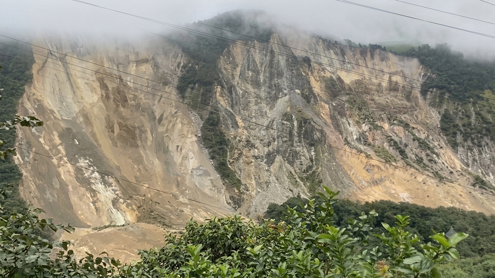
Entire cliffsides suddenly give way, sending millions of tons of stone and mud crashing directly into raging Himalayan waters. That is the terrifying reality facing communities along Nepal's river corridors, where recent catastrophic mountain collapses have rewritten local geography in seconds. When a mountainside fails above a rushing river, it triggers a chain reaction that puts entire villages, vital roadways, and downstream hydropower projects in immediate peril.
If you have watched the viral footage capturing these colossal geological events, you know the sheer, terrifying speed of the destruction. One second you see a towering ridge of rock and earth, and the next, an entire slope liquefies, avalanching into the valley below and creating massive, unstable temporary dams.
Understanding why these catastrophic landslides happen requires looking past the dramatic video clips and examining the fragile geology of the region. The Himalayas are among the youngest and most tectonically active mountain ranges on Earth. They are literally still growing, which means the rock is heavily fractured, unstable, and constantly subjected to extreme seismic stress.
Heavy monsoon downpours compound this natural vulnerability. When torrential rains hammer steep mountain slopes, water saturates the soil and infiltrates microscopic cracks in the bedrock. The sheer weight of the water acts as a lubricant, pushing unstable earth past its tipping point. Human activity plays a heavy role, too. Unregulated road construction cuts deep into the toes of fragile slopes, removing structural support and leaving entire hillsides waiting for the next heavy rain or tremor to trigger a collapse.
When a mountain collapses into a river, the immediate danger is rarely just the landslide itself. The falling debris forms a massive natural dam across the channel, blocking the water flow completely. Behind this makeshift barrier, a dangerous artificial lake begins to grow rapidly.
Communities downstream live under a terrifying countdown. If the newly formed barrier holds water for too many hours, the pressure builds until the dam bursts catastrophically. This unleashes a wall of water, mud, and debris known as a glacial lake outburst flood or landslide dam outburst flood. These surges wipe out bridges, wash away homes, and scour riverbanks clean for miles downstream.
The social and economic fallout of these disasters hits rural mountain populations the hardest. Nepal's rugged terrain means that critical supply lines, local trade routes, and vital transportation networks often run right alongside major rivers. When a massive landslide buries a highway, isolated mountain districts lose access to food, medical supplies, and emergency rescue services for days or weeks.
Rebuilding these routes is an engineering nightmare. Crews cannot simply clear the road with a bulldozer when thousands of tons of unstable rock continue to shift precariously overhead. Every attempt to clear the debris risks triggering secondary collapses that endanger heavy equipment operators and engineers.
Hydropower development faces an existential threat from these frequent river-blocking landslides. Energy companies invest billions of dollars constructing run-of-the-river power plants deep within narrow Himalayan gorges. A single major mountain collapse sends an unprecedented volume of sediment, boulders, and debris straight into the intake structures, destroying turbines, filling reservoirs, and knocking critical regional power grids offline for months.
Predicting these catastrophic slope failures before they happen remains one of the toughest challenges for geologists working in high-altitude environments. You cannot put a monitoring sensor on every unstable cliff face in the country.
Researchers now rely heavily on satellite remote sensing, radar interferometry, and seismic monitoring networks to detect subtle ground movements weeks before a slope finally lets go. Communities living in high-risk river corridors also participate in early-warning systems, using sirens and mobile alerts to evacuate the riverbanks the moment upstream water sensors detect abnormal blockages or sudden drops in flow.
The threat of catastrophic mountain collapses in Nepal is not going away. Changing climate patterns, characterized by increasingly erratic and intense monsoon downpours, mean that slope failures will likely become more frequent and more destructive in the coming years.
Adapting to this hazardous reality requires a fundamental shift in how infrastructure is planned and built across the region. Engineers must move away from vulnerable valley floors and design structures that account for extreme geological volatility. For the people living in the shadow of these towering, fragile peaks, vigilance and rapid-response preparedness remain the only real defense against a landscape that can change forever in a matter of seconds.