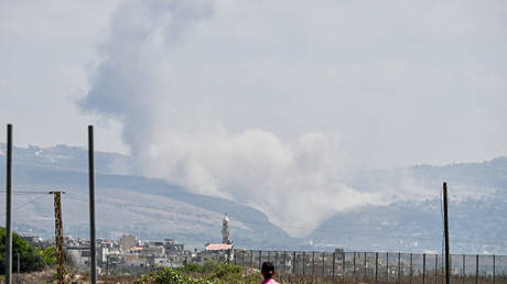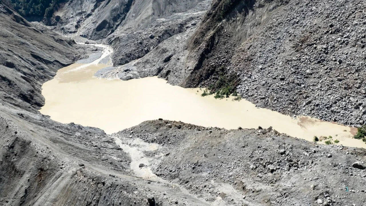
Relief rippled through government briefing rooms when satellite data confirmed that the high-altitude reservoir formed by the recent Langtang glacier collapse had begun to drain. The surface area of the impoundment on the Purepu Tsangpo river shrank by more than twenty thousand square meters over a forty-eight-hour window, reducing fears of an immediate catastrophic secondary outburst that could wipe out downstream search parties. State-operated media and local disaster authorities pointed to the receding waters as a sign that the acute danger phase was subsiding.
The celebration of a draining temporary lake misses the broader, more terrifying mechanical reality of the Third Pole. Focusing narrowly on whether a single debris-blocked pool will breach distracts from the systemic collapse of the Hindu Kush Himalayan cryosphere. A shrinking puddle high above the border does not mean the mountains are stabilizing. It means the ice is running out, and every warm monsoon season now serves as an open-ended invitation for more catastrophic mass movements.
The Anatomy of a High-Altitude Failure
To understand why the easing of a single lake is little more than a temporary reprieve, one must look at the mechanics of the disaster that triggered the current crisis. When a massive section of the Langtang Lirung glacier detached from an altitude exceeding five thousand meters, it did not slide gracefully down a slope. It initiated a high-velocity cascade of bedrock, ice, and pulverized stone that transformed into a mud and debris torrent within minutes.
The resulting surge raised local river levels by nearly nine meters in less than half an hour, obliterating the Rasuwagadhi border complex and knocking dozens of hydropower facilities offline. Geological surveys confirmed there was no tectonic earthquake to blame. Instead, the prime suspect points squarely to a combination of internal structural fatigue and aggressive thermal melting across an over-steepened rock face.
When the lower tongue of a glacier shears away, it leaves behind an unstable scar of loose moraine, fractured granite, and secondary water pockets. Officials watching the shrinking surface area of the primary lake ignore the hidden reservoirs accumulating silently nearby. Engineers from regional monitoring bodies have already flagged adjacent pools sitting at the foot of the collapsed zone, some spanning over one hundred thousand square meters with unknown depths.
The Data Vacuum in the High Valleys
Decades of field research across the Himalayas reveal a persistent, dangerous gap in hazard assessment. Authorities react with sophisticated radar and drone surveillance only after a disaster strikes. State engineering firms deploy advanced monitoring equipment to watch a bursting lake only once the village below has already been buried in meters of grey sludge.
This is a reactive posture disguised as proactive crisis management. The scientific community lacks real-time subsurface data for the majority of high-altitude glaciers. Field instruments cannot survive the crushing kinetic force of an ice avalanche, leaving researchers to guess at the internal water pressure of internal glacial conduits until a blowout occurs.
Consider a hypothetical scenario that illustrates this blindness. If a subsurface ice cave within a retreating glacier fills with meltwater during an unseasonably warm afternoon, surface satellite imagery will register nothing unusual until the internal pressure exceeds the shear strength of the surrounding rock. By the time optical sensors or radar pick up surface displacement, the wave is already entering the narrow gorge above downstream settlements.
[Glacier Retreat & Internal Melting]
       │
       ▼
[Subsurface Water Accumulation (Invisible to Surface Sensors)]
       │
       ▼
[Catastrophic Structural Failure / Ice-Rock Avalanche]
       │
       ▼
[Debris Flow Amplification in Narrow Gorges]
       │
       ▼
[Downstream Impact Before Warning Systems Trigger]
Policy Failures and Infrastructure Hubris
The economic cost of this scientific blind spot is staggering. Hydroelectric projects worth billions of dollars are routinely sited along narrow Himalayan river corridors without accounting for the multi-megaton kinetic energy of a collapsing mountainside. Planners design spillways and dams to handle maximum historical water discharge rates, treating glacial outburst floods and debris avalanches as statistical anomalies rather than recurring design parameters.
When infrastructure fails, the blame is routinely deflected toward unpredictable natural fury. Yet the acceleration of ice loss across the region has been documented exhaustively for years. Assessments published by regional climate centers show that ice thinning rates have doubled over the past two decades. Small glaciers spanning less than half a square kilometer are disappearing at an alarming rate, losing their grip on steep valley walls and transforming into loose sediment ready to mobilize with the first heavy rain.
Governments prefer to report that a danger has "wanes" because reporting the chronic, permanent destabilization of an entire mountain range requires an expensive, generational overhaul of regional land-use planning. Moving border trade hubs away from narrow river confluences, relocating valley-floor communities, and halting the construction of vulnerable run-of-the-river hydro plants are politically toxic propositions.
The Reality of Secondary Threats
Even as the immediate reservoir drains naturally, the broader valley remains a fragile hazard zone. Search and rescue operations crawl over fields of jagged boulders where access roads have been erased. Heavy monsoon rains continue to saturate unstable landslide scars, threatening to send secondary mudflows down the Trishuli and Bhote Koshi river basins.
The official narrative of a danger subsiding offers psychological comfort to populations weary of tragedy. It provides an excuse to wind down emergency response postures and return to normal economic activity in zones that should long ago have been designated unlivable.
The lake near the border may be shrinking today, but the thermal engine driving the collapse of the Himalayas continues to accelerate every single summer. Until disaster management shifts from counting bodies and watching drying puddles to confronting the permanent transformation of high-altitude hydrology, the next catastrophe is only a matter of time.