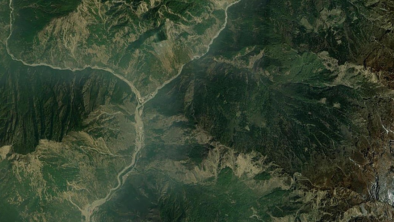
High-resolution radar imaging captured by orbital surveillance over the Nepal-Tibet border lays bare a terrifying geological reality. A massive wedge of bedrock and hanging glacier on the slopes of Langtang Lirung detached, plunging more than a vertical kilometer into the valley below. The resulting ice-rock avalanche generated a catastrophic flash flood that scoured riverbanks, obliterated infrastructure, and left downstream communities buried under meters of mud and debris. Yet, the availability of sharp radar frames post-disaster highlights an uncomfortable truth. We possess the technology to photograph a disaster from space with astonishing clarity, but we remain dangerously blind to the cascading tectonic and thermal mechanics ticking away above our heads until it is too late.
Orbital data feeds have become the default currency of modern crisis reporting. When the mountainside gave way, attention quickly turned to what remote sensing could reveal. Synthetic aperture radar systems, capable of peering through cloud cover and heavy atmospheric dust that typically blind optical sensors, delivered stark before-and-after comparisons. These images allowed geomorphologists to trace the failure zone up to the cliffs north of Langtang Lirung. They revealed that the event was not merely a surface-level ice detachment, but a catastrophic structural failure of the mountain's core. The bedrock itself sheared off, dragging millions of tons of glacial mass into a hyper-accelerated descent. Meanwhile, you can read related developments here: Nepal Flood Disasters The Structural Anatomy of Systematic Emergency Failure.
The Physics of a Vertical Drop
Understanding the sheer destructive power of the event requires looking past the imagery and into the physics of high-altitude mechanics. When a massive block of ice and stone drops from an altitude near 5,200 meters, potential energy converts into kinetic energy with brutal efficiency.
- Gravitational Acceleration: A drop exceeding 1,200 vertical meters turns falling debris into a high-velocity projectile.
- Energy Dissipation: The impact force acts like an explosive detonation, instantly pulverizing solid ice into a fluid slurry of water, mud, and boulders.
- Momentum Amplification: Steep, narrow river valleys act as functional funnels, maintaining forward momentum over dozens of miles.
This dynamic transformation explains why initial seismic monitoring equipment mistook the collapse for an earthquake. The ground shuddered under the sheer mass of the impact, registering a magnitude equivalent to tectonic shifts. As the pulverized mixture slammed into the Lhende Khola and Bhotekoshi river systems, it created an unmanageable surge. Bridges vanished, hydroelectric installations were overwhelmed, and towns like Syapru Besi were swallowed by rolling walls of brown sediment. To see the full picture, we recommend the detailed report by Al Jazeera.
The Permafrost Factor
Pinpointing the exact catalyst behind the slope failure exposes the friction points within contemporary climate science. While researchers are quick to note the overarching context of global warming, establishing a direct linear cause for a specific slope failure remains analytically complex.
High-altitude permafrost acts as the invisible glue of the Himalayas. For millennia, frozen water cemented fractures within bedrock and stabilized glacial toes. As regional temperatures rise faster than the global average, that thermal baseline shifts. Permafrost thaws, internal water pressures fluctuate, and structural integrity degrades.
Independent field specialists emphasize that structural loading compounds these natural vulnerabilities. Heavy infrastructure development, including ambitious cross-border hydroelectric projects and expanding road networks carved into steep valley walls, alters local hydrology and slope stability. When heavy seasonal moisture meets compromised permafrost, the margin for error evaporates entirely. Space-based radar can measure the scar left behind, but it cannot continuously quantify the sub-surface thermal decay weakening the rock from within.
The Limits of Orbital Surveillance
Relying on radar satellites as an early warning mechanism exposes a fundamental mismatch between orbital capabilities and ground-level realities. Satellites follow fixed orbital paths. They revisit a specific coordinate on a periodic schedule, often leaving multi-day gaps between passes. Even with constellations providing frequent revisits, spotting a destabilizing slope before it fails is structurally equivalent to searching for a microscopic needle in a vast, rugged haystack.
Mountainous terrain introduces severe geometric distortions in radar imagery. Steep relief creates radar shadows and layover effects, masking minor structural shifts on vertical cliff faces until a major displacement alters the surface signature permanently. By the time an analyst processes an interferometric synthetic aperture radar scan showing surface deformation, the physical rock may already be airborne.
Communities living in the shadow of these peaks cannot afford to wait for post-disaster orbital validation. Effective mitigation requires localized sensor networks, real-time acoustic monitors along river channels, and continuous pore-pressure tracking inside high-risk slopes. Spaceborne sensors remain invaluable for forensic reconstruction and broad hazard mapping, but they serve as coroners rather than guardians. Until ground-level early warning instrumentation catches up with the speed of high-altitude destabilization, valleys downstream will remain at the mercy of sudden shifts in the roof of the world.