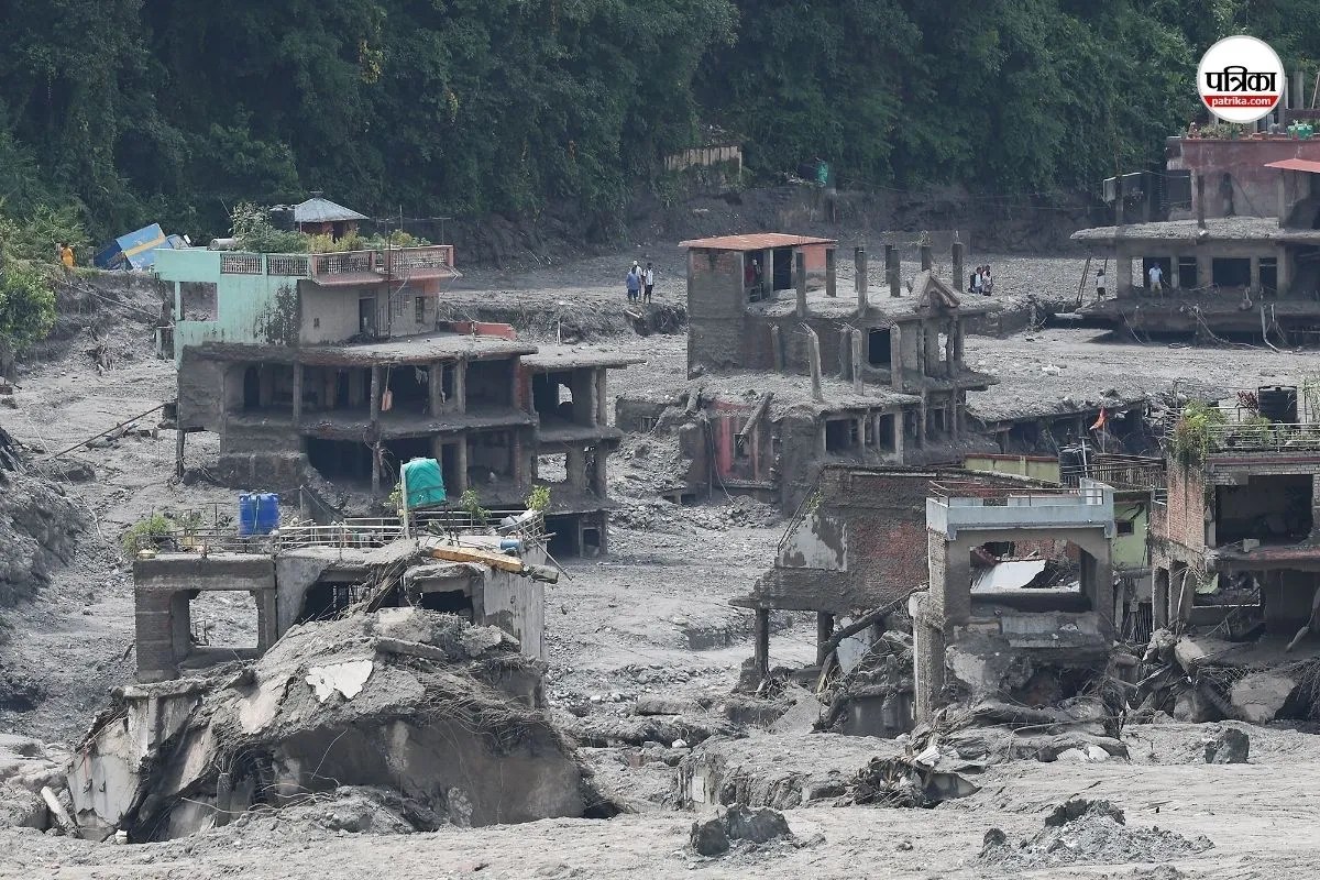
Geophysical catastrophes in high-mountain ecosystems rarely unfold as isolated weather events. When a high-altitude glacier collapses along the China-Nepal border, triggering a multi-tiered hydraulic surge across the Bhote Koshi and Trishuli river corridors, the resulting devastation exposes severe vulnerabilities in regional warning systems, cross-border data sharing, and civil infrastructure planning. Moving past surface-level tragedy requires analyzing the physical mechanics, systemic failures, and cascading secondary risks that define modern Himalayan flash floods.
The Mechanics of Glacier Collapse and Hydraulic Surges
Conventional flood risk models in South Asia focus heavily on monsoon-driven river swell or Glacial Lake Outburst Floods, where a moraine wall breaches and releases impounded water over hours or days. The catastrophic event on August 26, 2026, operated on an entirely different physical profile. Satellite telemetry and seismic analysis confirmed that a massive section of bedrock beneath a high-altitude glacier collapsed, registering as a magnitude 5.2 seismic event without a tectonic origin.
This massive ice-rock avalanche plummeted into narrow river valleys, instantly displacing millions of cubic meters of water and debris. The kinetic energy transformed into an aggressive debris flow. Water levels on key river systems surged by up to nine meters within thirty minutes. Traditional monitoring infrastructure, optimized for gradual seasonal water accumulation, was entirely unequipped to measure or transmit data ahead of a wall of water moving at highway speeds. Settlements, roads, bridges, and hydroelectric facilities located downstream were obliterated before emergency protocols could be initiated.
The Architecture of Systemic Vulnerability
Disaster impact is a direct function of exposure multiplied by vulnerability, divided by institutional response capacity. In the rugged borderlands between Nepal and the Tibet Autonomous Region, several distinct variables compounded the mortality and economic loss.
- Geographic Isolation and Infrastructure Density: Valleys such as Rasuwa are constrained by steep topography, forcing human settlements, trade routes, and energy infrastructure into narrow strips of habitable land directly adjacent to riverbanks.
- Cross-Border Information Latency: The origin point of the disaster lies upstream in high-altitude Chinese territory, while the heaviest downstream populated impacts manifest in Nepal. Real-time telemetry sharing across national borders remains fragmented, creating critical delays in warning transmission.
- Secondary Impoundment Risks: Following the initial flush, debris accumulations frequently form temporary landslide dams. These barrier lakes store massive volumes of water upstream, threatening secondary flash floods that force the repeated suspension of search and rescue operations.
The Economic and Human Toll Function
Assessing the cost of such disasters extends far beyond immediate casualty figures. The destruction of major transport arteries like the Gyirong Port border crossing severs vital cross-border commerce. Furthermore, the loss of active hydropower plants places long-term pressure on national energy grids, straining recovery financing.
Emergency response teams face unique operational bottlenecks. Search operations span hundreds of kilometers down to the plains of Chitwan, complicated by thick layers of dark brown mud, destroyed access bridges, and thousands of missing persons, including international pilgrims and tourists visiting during peak regional travel seasons. The concentration of vulnerable infrastructure near unstable slopes guarantees that economic recovery will lag years behind immediate humanitarian relief.
Strategic Realignment for High-Altitude Risk Mitigation
Mitigating future events demands a wholesale transition from reactive disaster management to predictive cryospheric monitoring. Governments and international scientific bodies must deploy synchronized sensor networks above the treeline, focusing on unstable permafrost and hanging glaciers rather than solely monitoring downstream river gauges. Integrating continuous satellite observation with automated acoustic and seismic sensors along transboundary river basins will shorten the warning value chain, providing minutes of actionable lead time that can save thousands of lives in high-risk mountain corridors.